
HAND PAINTED AERIAL MAPS of the Lake District, Ireland, North Wales and Great War Battlefields
The Fir Tree Series of Aerial Maps has been created by cartographic artist Richard Chandler.
The original artworks were painted using hand-made models and Ordnance Survey mapping.
Maps are available either in local shops or online (see below). Please contact Richard if you would like to stock any of the range.
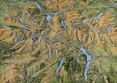
THE FIR TREE SERIES OF AERIAL MAPS – THE LAKE DISTRICT
Click the map to buy
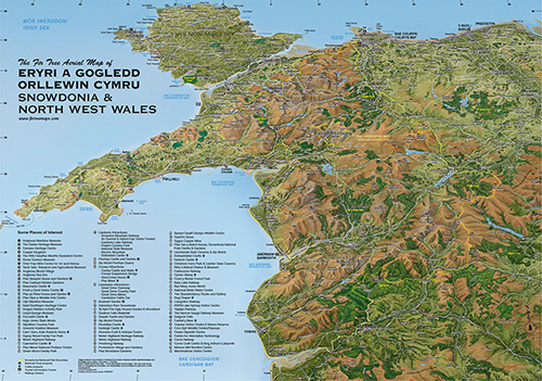 THE FIR TREE SERIES OF AERIAL MAPS – SNOWDONIA
Click the map to buy
Click the map to buy
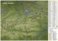 THE FIR TREE MAP OF THE YPRES SALIENT
Click the map to buy
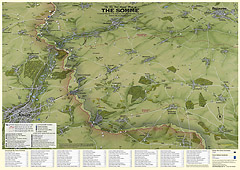 THE FIR TREE MAP OF THE SOMME
Click the map to buy